(Cross posted from the Lat Long blog)

From your own backyard all the way to Mount Everest, Google Maps and Google Earth are here to help you explore the world. You can learn to harness the world’s most comprehensive and accurate mapping tools by registering for Mapping with Google.

Mapping with Google is a self-paced, online course developed to help you better navigate the world around you by improving your use of the new Google Maps, Maps Engine Lite, and Google Earth. All registrants will receive an invitation to preview the new Google Maps. 

Through a combination of video and text lessons, activities, and projects, you’ll learn to do much more than look up directions or find your house from outer space. Tell a story of your favorite locations with rich 3D imagery, or plot sights to see on your upcoming trip and share with your travel buddies. During the course, you’ll have the opportunity to learn from Google experts and collaborate with a worldwide community of participants, via Google+ Hangouts and a course forum.

Mapping with Google will be offered from June 10 - June 24, and you can choose whether to explore the features of Google Maps, Google Earth, or both. In addition, you’ll have the option to complete a project, applying the skills you’ve learned to earn a certificate. Visit g.co/mappingcourse to learn more and register today.

The world is a big place, we like to think that you can make it a bit more manageable and adventurous with Google’s mapping tools.

Posted by Tina Ornduff, Program Manager


(Cross posted from the Official Google Blog)

The Galapagos Islands are some of the most biologically unique ecosystems in the world. Explorers and scientists alike have long studied and marveled at these islands—made famous by Charles Darwin. The Ecuadorean Government, local conservation groups and scientists are working to protect the Galapagos from threats posed by invasive species, climate change and other human impacts.


It’s critical that we share images with the world of this place in order to continue to study and preserve the islands’ unique biodiversity. Today we’re honored to announce, in partnership with Charles Darwin Foundation (CDF) and the Galapagos National Parks Directorate (GNPD), that we’ve collected panoramic imagery of the islands with the Street View Trekker. These stunning images will be available on Google Maps later this year so people around the world can experience this remote archipelago.

Daniel Orellana of Charles Darwin Foundation crossing a field of ferns to reach Minas de Azufre (naturally-occurring sulfur mines) on the top of Sierra Negra, an active volcano on Isabela Island. The Google Maps team traveled for more than 3 hours, hiking and on horseback, to reach this remote location.

Images, like the one you see above, are also an important visual record that the CDF and GNPD will use to study and protect the islands by showing the world how these delicate environments have changed over time.

Daniel Orellana of the Charles Darwin Foundation climbs out of a lava tunnel where he was collecting imagery. The dramatic lava landscapes found on Isabela island tell the story of the formation of the Galapagos Islands.

Our 10-day adventure in the Galapagos was full of hiking, boating and diving around the islands (in hot and humid conditions) to capture 360-degree images of the unique wildlife and geological features of the islands with the Trekker. We captured imagery from 10 locations that were hand-selected by CDF and GNPD. We walked past giant tortoises and blue-footed boobies, navigated through steep trails and lava fields, and picked our way down the crater of an active volcano called Sierra Negra.

A Galapagos giant tortoise crawls along the path near Googler Karin Tuxen-Bettman while she collects imagery with the Street View Trekker in Galapaguera, a tortoise breeding center, which is managed by the Galapagos National Park Service.

Life underwater in the Galapagos is just as diverse as life on land. We knew our map of the islands wouldn’t be comprehensive without exploring the ocean that surrounds them. So for the second time we teamed up with the folks at the Catlin Seaview Survey to collect underwater panoramic imagery of areas being studied by CDF and GNPD. This imagery will be used by Catlin Seaview Survey to create a visual and scientific baseline record of the marine environment surrounding the islands, allowing for any future changes to be measured and evaluated by scientists around the world.

Christophe Bailhache navigates the SVII camera through a large group of Sea Lions at Champion Island in Galapagos. Image courtesy of the Catlin Seaview Survey.

We truly believe that in order to protect these Galapagos Islands, we must understand them. As they say, “a picture is worth a thousand words.” We hope this Street View imagery not only advances the important scientific research, but also inspires you to learn more about this special place. Stay tuned for updates on this collection—the first time we’ve captured imagery from both land and sea! We can’t wait to share this amazing imagery with you later this year.

Posted by Raleigh Seamster, Project Lead, Google Maps


Do you use Google Earth to visualize your data or tell your stories? Do you need to create more professional and informative maps for printing, or want to know if that new construction site will be visible from your hilltop park? Now you can do all of these things quickly and easily using Google Earth Pro 7.1.

A few weeks ago on Earth Day, we announced the latest update to Google Earth Pro. The update includes new tools that will help with the incredible work you do. To get started using the new features, check out the information and examples below.

Advanced Map Making & Printing
Add cartographic features to the maps you make in Google Earth Pro, including legends, titles, scale bars, north-arrows and text boxes. You can use these features when saving your map as an image or PDF for sharing with your colleagues and supporters, or when printing your map for use in the field. They will help make your maps more professional looking and informative. See this video for details.

Viewshed Analysis
Need to find out whether your field camp is within line-of-sight of the cell phone tower? Just use the viewshed tool in Google Earth Pro. All you need to do is create a placemark, give it an appropriate altitude relative to the ground, and select “Show Viewshed” to see what’s visible from that spot. Find out more here.


I made the map above in less than 5 minutes, and it’s ready to send to my colleagues. Try it out for yourself. If you don’t already have Google Earth Pro, you can find out more here, or if you’re a nonprofit, you can get it for free.

Happy mapping!

Posted by Christiaan Adams, Developer Advocate, Google Earth Outreach


At Google, one of our goals is to help make the web work for you. Today we’re announcing a new series of Learn with Google webinars, which will teach you how to use digital to build brand awareness and give you the tools you need to drive sales and grow loyalty and retention. Each of our sessions gives you deep-dive educational content, across a breadth of products and marketing objectives, in a format that’s convenient for you. Every webinar is led by Google product experts and includes time for audience Q&A. Sign up to start becoming a smarter digital marketer now.

Upcoming live webinars:

May
[YouTube] Driving Direct Response with Video
[Shopping] Google Shopping 101: Google Shopping for Beginners
[Research] New Research: How US Shoppers use Smartphones in Stores
[Mobile] Driving Deeper Engagement with your App Users
[Mobile] Driving Brand Engagement with Mobile Rich Media
[Analytics] Measuring Success in a Multi-Device World

June
[Mobile] Understanding Mobile Ads Across Marketing Objectives
[Shopping] Google Shopping 201: Merchant Center Deep Dive
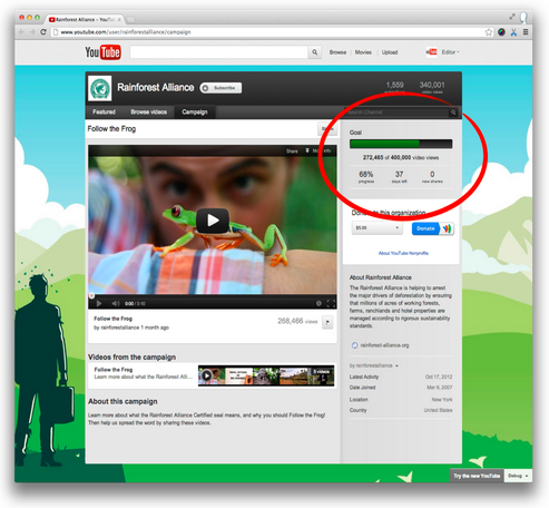
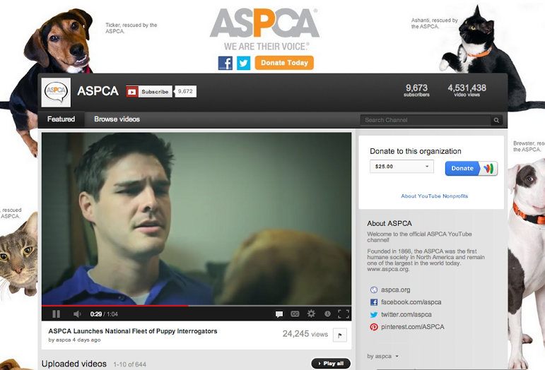
[YouTube] Building your Business with YouTube Video Ads
[Analytics] Metrics for the Mobile App Ecosystem
[Search] What's New & Next in AdWords
[Analytics] Unleashing the Combined Power of Google Analytics & AdWords
[Social] Growing your Business & Engaging your Audience with Google+
[Shopping] Google Shopping 301: Creating & Optimizing Product Listing Ads
[Social] Launching & Amplifying your Impact Across Social Channels
[Display] Reaching the Right Audience with Remarketing
[Research] Creating Custom Infographics with the New Google Databoard

Webinars are held Tuesdays through Thursdays at 10am Pacific/1pm Eastern.

Visit our webinar site to register for any of the live sessions and to access our large library of recorded content. You can also stay up-to-date on the schedule by adding our Learn with Google calendar to your own Google calendar to automatically see upcoming webinars.

During our last series of webinars, attendees had the chance to win a Nexus 7. Clint Wilson was our lucky winner and he’ll soon be enjoying all of the tablet’s cool features. Check out our upcoming webinars for another chance to win!

Learn with Google is a program to help businesses succeed through winning moments that matter, enabling better decisions and constantly innovating. We hope that you’ll use these best practices and how-to’s to maximize the impact of digital and grow your business. We’re looking forward to seeing you at an upcoming session!

Posted by Erin Molnar, Marketing Coordinator, Learn with Google


  1. Reach goals with your viewers using the Campaigns feature. The Campaigns feature on YouTube encourages viewers to contribute towards goals that you set, such as increasing views or subscribers. We recently launched the ability to set the goal of number views for your whole channel. With the help of Campaigns, Sesame Street became the first nonprofit organization to reach over a billion viewers of videos on their channel. Learn how to create your campaign and begin using the feature here.

Over the past few weeks, we’ve explored how YouTube can help you reach and engage new supporters, long term volunteers and donors on our Google+ page. We’ve shared tips on how to maximize the effect of existing videos, ideas for creating new ones and organizations who are already inspiring action with their Youtube channels and playlists. If you missed it, here are five ways your nonprofit can make the most of YouTube today.

  1. Reach goals with your viewers using the Campaigns feature. The Campaigns feature on YouTube encourages viewers to contribute towards goals that you set, such as increasing views or subscribers. We recently launched the ability to set the goal of number views for your whole channel. With the help of Campaigns, Sesame Street became the first nonprofit organization to reach over a billion viewers of videos on their channel. Learn how to create your campaign and begin using the feature here.


  1. Become a regular. Just as it's important for you to maintain a consistent fundraising schedule, the same rule applies to how you program content on YouTube. Stick to a consistent schedule and regularly produce and share timely and relevant videos. Making video a regular part of your fundraising activities can help extend the impact of your campaign. Looking for inspiration? Rainforest Action Network and Oxfam GB create regular thematic content and then organize the videos into featured playlists on their channels.

  1. Turn video views into dollars raised with the Google Wallet “Donate” Button. All registered YouTube nonprofit partners can use a Google Wallet “Donate” button. Once you sign up as a nonprofit, go to your Google Wallet Options, enter your ID and Merchant Key, and choose donation amounts. When you’ve filled in the information, the button will appear on your public profile and on your video pages. You can find the Google Wallet options in the upper right-hand corner of “My Channel” and click on the “Add Donation Module” button. The button appears on both your channel page and the watch video pages.


  1. Let your viewers drive with Annotations. If you want to be really creative about how you get your message across, try using Annotations to create an interactive, “choose-your-own-adventure” style video. This video from Droptheweapons.org for the “Drop the Weapons” campaign lets the viewer decide what to do in a series of life or death decisions. It’s intended to educate kids about the consequences of making the wrong decisions.


  1. Don’t let your shoestring budget keep you from making great videos. You don’t need fancy equipment and years of experience to tell a compelling story on YouTube. In fact, many nonprofits make the biggest impact with YouTube by posting authentic and scrappy videos on a regular schedule. You can hear these nonprofits’ stories (and more tips) by watching this Hangout:


If you want to learn more about how you can use YouTube to tell your story, your first step is to make sure you’re registered with Google for Nonprofits. If you’ve been accepted into the program, you can start using YouTube for Nonprofits. Then, check out our ‘Playbook for Good’ which is full of best practices and handy tips. We can’t wait to watch the stories you tell!

Posted by Jessica Mason, YouTube Nonprofit team